Steep Holm
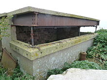
Island in the Bristol Channel, United KingdomSteep Holm is an English island lying in the Bristol Channel. The island covers 48.87 acres (19.78 ha) at high tide, expanding to 63.26 acres (25.60 ha) at mean low water. At its highest point it is 78 metres (256 ft) above mean sea level. Administratively it forms part of the unitary authority of North Somerset within the ceremonial county of Somerset; between 1 April 1974 and 1 April 1996, it was administered as part of Avon. Nearby is Flat Holm island, part of Wales.
Read article
Top Questions
AI generatedMore questions
Nearby Places

Flat Holm
Welsh island in the Bristol Channel

Brean Down Fort
19th-century military fortification in Somerset, England

Brean Down
Promontory in Somerset, England
The Wolves (Bristol Channel)
Rocky islets off Wales in Bristol Channel

Weston Bay

Birnbeck Pier
Pier in Weston-super-Mare

Brean
Village and civil parish in Somerset, England
Bristol Channel Fault Zone


